
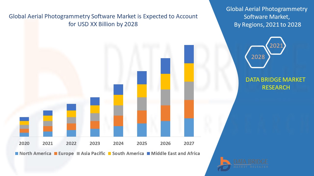
Global Aerial Photogrammetry Software Market
市场规模(十亿美元)
CAGR :
% 
 USD
2.42 Billion
USD
7.80 Billion
2025
2033
USD
2.42 Billion
USD
7.80 Billion
2025
2033
| 2026 –2033 | |
| USD 2.42 Billion | |
| USD 7.80 Billion | |
| % | |
|
Global Aerial Photogrammetry Software Market, By Photogrammetry Style (Point-and-Shoot Photogrammetry, Multi Camera Photogrammetry, Video-To-Photogrammetry), Application (3D Printing, Drones and Robots, Topographic Maps, Culture Heritage and Museum, Films and Games, Traffic Management, Other Applications), End User (Building and Construction, Automotive, Energy, Oil and Gas, Ship Building, Others), Country (U.S., Canada, Mexico, Brazil, Argentina, Rest of South America, Germany, Italy, U.K., France, Spain, Netherlands, Belgium, Switzerland, Turkey, Russia, Rest of Europe, Japan, China, India, South Korea, Australia, Singapore, Malaysia, Thailand, Indonesia, Philippines, Rest of Asia-Pacific, Saudi Arabia, U.A.E, South Africa, Egypt, Israel, Rest of Middle East and Africa) Industry Trends and Forecast to 2028
 Market Analysis and Insights : Global Aerial Photogrammetry Software Market
The demand for aerial photogrammetry software is expected to see market growth in the forecast period from 2021 to 2028 at a rate of 15.70%. The Data Bridge Market Research Report on the market for aerial photogrammetry software offers analysis and insights into the various factors that are expected to be prevalent during the forecast period while providing their influence on the growth of the market.
The art and science of extracting 3D information from photographs is known as photogrammetry. Comparing and matching pixels or reference points through a sequence of object, structure, or space photographs does this. These images can then be processed by photogrammetry software such as agisoft photoscan or autodesk remake, and a 3D mesh is created by matching and triangulating visual features. Photogrammetry is often used by surveyors, architects, engineers, and contractors in order to create topographic maps, meshes, point clouds, or drawings based on the real-world.
Increasing demand from engineers, surveyors and architects, easy availability of the affordable aerial drones, software developers have published commercial solutions that are ideal for industrial and engineering purposes, rising need of photogrammetry software for improving disaster management, increasing growth of the construction industry across the globe are some of the major as well as vital factors which will likely to augment the growth of the aerial photogrammetry software market in the projected timeframe of 2021-2028. On the other hand, increasing adoption of photogrammetry software in automobile industry along with rising number of technological advancement which will further contribute by generating massive opportunities that will lead to the growth of the aerial photogrammetry software market in the above mentioned projected timeframe.
Inaccurate measurement in bad weather conditions along with lack of skilled and technical expertise which will likely to act as market restraints factor for the growth of the aerial photogrammetry software in the above mentioned projected timeframe. Rising popularity of 3D scanning which will become the biggest and foremost challenge for the growth of the market.
This aerial photogrammetry software market report provides details of new recent developments, trade regulations, import export analysis, production analysis, value chain optimization, market share, impact of domestic and localised market players, analyses opportunities in terms of emerging revenue pockets, changes in market regulations, strategic market growth analysis, market size, category market growths, application niches and dominance, product approvals, product launches, geographic expansions, technological innovations in the market. To gain more info on aerial photogrammetry software market contact Data Bridge Market Research for an Analyst Brief, our team will help you take an informed market decision to achieve market growth.
Global Aerial Photogrammetry Software Market Scope and Market Size
Aerial photogrammetry software market is segmented on the basis of photogrammetry style, application and end user. The growth among segments helps you analyse niche pockets of growth and strategies to approach the market and determine your core application areas and the difference in your target markets.
- Aerial photogrammetry software market on the basis of hardware has been segmented as point-and-shoot photogrammetry, multi camera photogrammetry, and video-to-photogrammetry.
- On the basis of application, the aerial photogrammetry software market has been segmented into 3d printing, drones and robots, topographic maps, culture heritage and museum, films and games, traffic management, and other applications.
- Aerial photogrammetry software has also been segmented on the basis of end user into building and construction, automotive, energy, oil and gas, ship building, and others.
Aerial Photogrammetry Software Market Country Level Analysis
Aerial photogrammetry software market is analysed and market size, volume information is provided by country, photogrammetry style, application and end user as referenced above.
The countries covered in the aerial photogrammetry software market report are U.S., Canada and Mexico in North America, Brazil, Argentina and Rest of South America as part of South America, Germany, Italy, U.K., France, Spain, Netherlands, Belgium, Switzerland, Turkey, Russia, Rest of Europe in Europe, Japan, China, India, South Korea, Australia, Singapore, Malaysia, Thailand, Indonesia, Philippines, Rest of Asia-Pacific (APAC) in the Asia-Pacific (APAC), Saudi Arabia, U.A.E, South Africa, Egypt, Israel, Rest of Middle East and Africa (MEA) as a part of Middle East and Africa (MEA).
The U.S. will dominate the North America aerial photogrammetry software market due to the surging levels of investment in research and development activities along with growing number of technological advancements, high digitalization rate and extensive use of photogrammetry software mainly for applications such as topographic mapping, architecture, and engineering in the region while Asia-Pacific region will expect to grow in the forecast period of 2021-2028 due to the increasing demand of the product along with increasing investment in development of infrastructure in India, and China.
The country section of the report also provides individual market impacting factors and changes in regulation in the market domestically that impacts the current and future trends of the market. Data points like down-stream and upstream value chain analysis, technical trends and porter's five forces analysis, case studies are some of the pointers used to forecast the market scenario for individual countries. Also, the presence and availability of global brands and their challenges faced due to large or scarce competition from local and domestic brands, impact of domestic tariffs and trade routes are considered while providing forecast analysis of the country data.
Competitive Landscape and Aerial Photogrammetry Software Market Share Analysis
Aerial photogrammetry software market competitive landscape provides details by competitor. Details included are company overview, company financials, revenue generated, market potential, investment in research and development, new market initiatives, regional presence, company strengths and weaknesses, product launch, product width and breadth, application dominance. The above data points provided are only related to the companies’ focus related to aerial photogrammetry software market.
The major players covered in the aerial photogrammetry software market report are Pix4D SA; 3Dflow SRL; Agisoft; Capturing Reality s.r.o.; nFrames; Vexcel Imaging GmbH; REDcatch GmbH; NUBIGON Inc.; Linearis3D GmbH & Co.KG; Menci Software Srl; Photometrix Photogrammetry Software; Skyline Software Systems; Racurs; SimActive Inc.; ICAROS; DroneDeploy; PhotoModeler Technologies; Esri Global, Inc.; Magnasoft.; Autodesk Inc.; Trimble Inc; Hexagon AB; among other domestic and global players. Market share data is available for global, North America, Europe, Asia-Pacific (APAC), Middle East and Africa (MEA) and South America separately. DBMR analysts understand competitive strengths and provide competitive analysis for each competitor separately.
SKU-
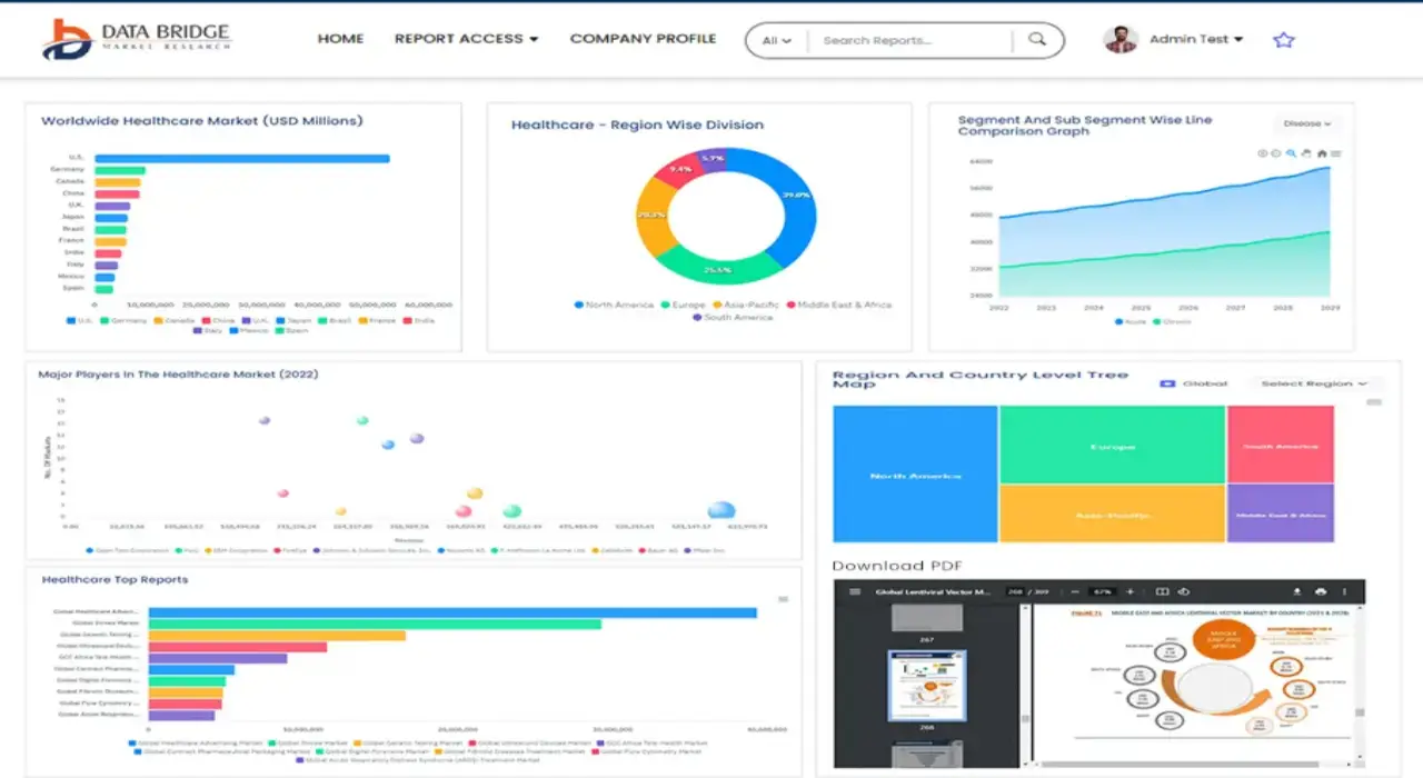
Get online access to the report on the World's First Market Intelligence Cloud
- Interactive Data Analysis Dashboard
- Company Analysis Dashboard for high growth potential opportunities
- Research Analyst Access for customization & queries
- Competitor Analysis with Interactive dashboard
- Latest News, Updates & Trend analysis
- Harness the Power of Benchmark Analysis for Comprehensive Competitor Tracking
研究方法
数据收集和基准年分析是使用具有大样本量的数据收集模块完成的。该阶段包括通过各种来源和策略获取市场信息或相关数据。它包括提前检查和规划从过去获得的所有数据。它同样包括检查不同信息源中出现的信息不一致。使用市场统计和连贯模型分析和估计市场数据。此外,市场份额分析和关键趋势分析是市场报告中的主要成功因素。要了解更多信息,请请求分析师致电或下拉您的询问。
DBMR 研究团队使用的关键研究方法是数据三角测量,其中包括数据挖掘、数据变量对市场影响的分析和主要(行业专家)验证。数据模型包括供应商定位网格、市场时间线分析、市场概览和指南、公司定位网格、专利分析、定价分析、公司市场份额分析、测量标准、全球与区域和供应商份额分析。要了解有关研究方法的更多信息,请向我们的行业专家咨询。
可定制
Data Bridge Market Research 是高级形成性研究领域的领导者。我们为向现有和新客户提供符合其目标的数据和分析而感到自豪。报告可定制,包括目标品牌的价格趋势分析、了解其他国家的市场(索取国家列表)、临床试验结果数据、文献综述、翻新市场和产品基础分析。目标竞争对手的市场分析可以从基于技术的分析到市场组合策略进行分析。我们可以按照您所需的格式和数据样式添加您需要的任意数量的竞争对手数据。我们的分析师团队还可以为您提供原始 Excel 文件数据透视表(事实手册)中的数据,或者可以帮助您根据报告中的数据集创建演示文稿。