Global Geographic Information System Gis Market
시장 규모 (USD 10억)
연평균 성장률 :
% 
 USD
9,270.20 Billion
USD
23,518.33 Billion
2022
2030
USD
9,270.20 Billion
USD
23,518.33 Billion
2022
2030
| 2023 –2030 | |
| USD 9,270.20 Billion | |
| USD 23,518.33 Billion | |
|
|
|
|
구성요소(하드웨어, 소프트웨어), 기능(매핑, 측량, 텔레매틱스 내비게이션, 위치 기반 서비스), 최종 사용자(농업, 석유 및 가스, 건설, 광산, 운송, 유틸리티, 기타)별 글로벌 지리 정보 시스템(GIS) - 2030년까지의 산업 동향 및 예측.

지리 정보 시스템(GIS) 시장 분석 및 규모
글로벌 지리 정보 시스템(GIS) 시장은 구성 요소, 기능 및 최종 사용자를 기준으로 세분화됩니다. 세그먼트 간 성장은 틈새 성장 포켓과 시장에 접근하고 핵심 응용 분야와 타겟 시장의 차이점을 파악하기 위한 전략을 분석하는 데 도움이 됩니다.
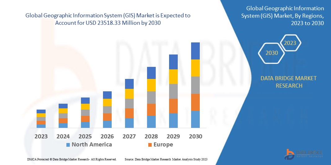
Data Bridge Market Research는 2022년에 92억 7,020만 달러였던 글로벌 지리 정보 시스템(GIS) 시장이 2030년까지 235억 1,833만 달러로 급증할 것으로 분석했으며, 예측 기간 동안 11.90%의 CAGR을 기록할 것으로 예상합니다. 이는 시장 가치를 나타냅니다. "하드웨어"는 스포츠 및 피트니스 부문이 착용자의 생리적 상태를 모니터링하여 스포츠, 피트니스 및 웰빙을 향상시키기 위해 스포츠 및 피트니스를 위한 웨어러블 전자 기기의 채택이 지속적으로 증가함에 따라 시장을 지배할 것으로 예상되기 때문에 글로벌 지리 정보 시스템(GIS) 시장의 유형 세그먼트를 지배할 것으로 예상됩니다. Data Bridge Market Research 팀이 큐레이팅한 시장 보고서에는 시장 가치, 성장률, 시장 세그먼트, 지리적 범위, 시장 참여자 및 시장 시나리오와 같은 시장 통찰력 외에도 심층적인 전문가 분석, 수입/수출 분석, 가격 분석, 생산 소비 분석 및 페슬 분석이 포함됩니다.
지리 정보 시스템(GIS) 시장 범위 및 세분화
|
보고서 메트릭 |
세부 |
|
예측 기간 |
2023년부터 2030년까지 |
|
기준 연도 |
2022 |
|
역사적 연도 |
2021 (2015-2020까지 사용자 정의 가능) |
|
양적 단위 |
매출은 백만 달러, 볼륨은 단위, 가격은 달러로 표시 |
|
다루는 세그먼트 |
구성 요소(하드웨어, 소프트웨어), 기능(매핑, 측량, 텔레매틱스 내비게이션, 위치 기반 서비스), 최종 사용자(농업, 석유 및 가스, 건설, 광산, 운송, 유틸리티, 기타) |
|
적용 국가 |
미국, 캐나다 및 멕시코(북미), 독일, 프랑스, 영국, 네덜란드, 스위스, 벨기에, 러시아, 이탈리아, 스페인, 터키, 유럽의 기타 유럽, 중국, 일본, 인도, 한국, 싱가포르, 말레이시아, 호주, 태국, 인도네시아, 필리핀, 아시아 태평양(APAC)의 기타 아시아 태평양(APAC), 사우디 아라비아, UAE, 이스라엘, 이집트, 남아프리카, 중동 및 아프리카(MEA)의 일부인 기타 중동 및 아프리카(MEA), 남미의 일부인 브라질, 아르헨티나 및 기타 남미 |
|
시장 참여자 포함 |
Environmental Systems Research Institute, Inc. (Esri) (미국), Hexagon (스웨덴), Pitney Bowes Inc. (미국), Autodesk Inc. (미국), Trimble Inc. (미국), Topcon (일본), Hi-Target. (중국), BENTLEY SYSTEMS, INCORPORATED (미국), Caliper Corporation (미국), Computer Aided Development Corporation Limited (Cadcorp) (영국), SuperMap Software Co., Ltd. (중국), L3Harris Technologies, Inc. (미국), Maxar Technologies (미국). |
|
시장 기회 |
|
시장 정의
지리 정보라는 소프트웨어 애플리케이션은 다양한 종류의 데이터를 평가, 생성, 유지 관리 및 매핑하는 데 사용됩니다. 위치 데이터를 인구 통계 데이터와 같은 다양한 설명적 데이터 유형과 결합하여 맵에 연결됩니다. 기술 덕분에 지리 데이터를 분석, 해석 및 시각화하여 추세, 패턴 및 관련 투자를 식별하는 것이 가능해졌습니다. 사용자는 GIS를 통해 관계, 추세 및 공간적 맥락을 더 잘 이해할 수 있습니다. 최근 매핑이 이 기술의 가장 중요한 역할이 되었습니다.
글로벌 지리 정보 시스템(GIS) 역학
운전자
- 스마트 시티와 현대 도시 계획의 개발
부지 선정, 토지 취득, 계획, 설계, 시각화, 건설, 프로젝트 관리, 운영 및 보고 프로세스는 모두 스마트 시티를 위한 지리 정보 시스템(GIS) 소프트웨어의 도움을 받습니다 . 지리 정보 시스템(GIS) 솔루션은 전문가가 도시 계획에서 장소를 더 적절하게 분석, 모델링 및 시각화하는 데 사용됩니다. 위성 이미징, 항공 사진 및 원격 센서에서 공간 데이터를 처리하여 지리 정보 시스템(GIS) 소프트웨어 시스템은 토지와 인프라에 대한 포괄적인 관점을 제공합니다. 이러한 지리 정보 시스템(GIS) 소프트웨어 응용 프로그램의 결과로 지리 정보 시스템 소프트웨어 산업은 예측 기간 동안 성장하고 있습니다.
- 스마트 시티와 현대 도시 계획의 개발
부지 선정, 토지 취득, 계획, 설계, 시각화, 건설, 프로젝트 관리, 운영 및 보고 프로세스는 모두 스마트 시티를 위한 지리 정보 시스템(GIS) 소프트웨어의 도움을 받습니다. 지리 정보 시스템(GIS) 솔루션은 전문가가 도시 계획에서 장소를 더 적절하게 분석, 모델링 및 시각화하는 데 사용됩니다. 위성 이미징, 항공 사진 및 원격 센서에서 지리 공간 데이터를 처리하여 지리 정보 시스템(GIS) 소프트웨어 시스템은 토지와 인프라에 대한 포괄적인 관점을 제공합니다. 이러한 지리 정보 시스템(GIS) 소프트웨어 응용 프로그램의 결과로 지리 정보 시스템 소프트웨어 산업은 예측 기간 동안 성장하고 있습니다.
기회
- 인공지능(AI)의 통합
인공지능(AI)과 지리정보시스템(GIS)의 통합은 시장에 수익성 있는 기회를 창출할 것으로 예상되며, 이는 시장 성장률을 더욱 확대할 것입니다. 주요 기업은 기술적 개선으로 인해 GIS와 인공지능 (AI)을 결합하고 있습니다. 예를 들어, AI를 사용하여 지리적 빅데이터에서 정보를 추출하는 지리공간 인공지능(GeoAI)의 등장은 정부가 스마트 시티를 만들고, 도시 인프라를 계획하고, 주어진 지역에서 시간 경과에 따른 변화를 모니터링하는 데 도움이 되었습니다.
- 사물인터넷(IoT)의 통합
또한 사물 인터넷(IoT)과 지리 정보 시스템(GIS)의 통합은 시장 내에서 수많은 성장 기회를 제공합니다. 사물 인터넷(IoT) 플랫폼이 비즈니스 운영에서 점점 더 많이 사용되어 고객에게 매우 관련성 있고 위치별 서비스를 제공함으로써 실시간 위치 데이터가 생성되고 있습니다. 또한 지리 정보 시스템(GIS)과 사물 인터넷(IoT) 장치를 결합하면 사용자는 공간 데이터 분석을 위한 정확한 데이터에 액세스할 수 있습니다. 예를 들어, 지리 데이터를 사용하여 전 세계 어느 위치에서나 IoT 지원 밸브를 모니터링할 수 있습니다.
제약/도전
- 높은 비용
값비싼 지리 정보 시스템은 전체 시장의 성장을 더욱 방해할 것입니다. 지리 정보 시스템(GIS)은 기술과 소프트웨어 외에도 적절한 자격을 갖춘 인력이 필요하기 때문에 비쌉니다. 고용하고 교육하는 데 비용이 많이 드는 지리 정보 시스템(GIS) 시스템에서 수집한 정보를 이해하고 해석하려면 전문 지식이 필요합니다. 따라서 이 요인은 예측 기간 동안 시장 성장을 방해할 것입니다.
최근 개발
- 2022년 6월, 센서, 소프트웨어, 디지털 리얼리티 솔루션 분야에서 수십억 달러 규모의 시장 리더인 Hexagon은 생산성과 ESG를 높이기 위해 스타트업을 지원하고 있습니다. Hexagon Manufacturing Intelligence Division은 SmartParts와 RIIIICO에 인정을 수여했습니다. 제조 부문의 효율성과 지속 가능성은 스타트업을 확장하고 최고 수준의 기업과의 연결을 확대하는 데 있어 오픈 혁신 플랫폼의 지원 덕분에 증가할 것입니다.
- 2022년 6월, Bentley Acceleration Initiatives에서 Construct Helix를 출시했습니다. Bentley Systems는 인프라 엔지니어링 소프트웨어 공급업체입니다. 연결된 데이터 환경을 가능하게 하는 SaaS 솔루션을 제공함으로써 건설 프로젝트 워크플로의 흐름을 디지털화하도록 특별히 설계되었습니다 .
글로벌 지리 정보 시스템(GIS) 범위
지리 정보 시스템(GIS) 시장은 구성 요소, 기능 및 최종 사용자를 기준으로 세분화됩니다. 이러한 세그먼트 간의 성장은 산업의 빈약한 성장 세그먼트를 분석하고 사용자에게 귀중한 시장 개요와 시장 통찰력을 제공하여 핵심 시장 애플리케이션을 식별하기 위한 전략적 결정을 내리는 데 도움이 됩니다.
요소
- 하드웨어
- GIS 수집가
- 이미징 센서
- 라이다
- 토탈 스테이션
- GNSS/GPS 안테나
- 소프트웨어
- 데스크탑 GIS
- 서버 GIS
- 개발자 GIS
- 모바일 GIS
- 원격 감지 소프트웨어
기능
- 매핑
- 측량
- 텔레매틱스 내비게이션
- 위치 기반 서비스
최종 사용자
- 농업
- 석유 및 가스
- 건설
- 채광
- 운송
- 유용
- 다른 사람들
글로벌 지리정보시스템(GIS) 시장 지역 분석/통찰력
지리 정보 시스템(GIS) 시장 보고서에서 다루는 국가는 다음과 같습니다. 북미의 미국, 캐나다 및 멕시코, 유럽의 독일, 프랑스, 영국, 네덜란드, 스위스, 벨기에, 러시아, 이탈리아, 스페인, 터키, 유럽의 기타 유럽 국가, 중국, 일본, 인도, 한국, 싱가포르, 말레이시아, 호주, 태국, 인도네시아, 필리핀, 아시아 태평양(APAC)의 기타 아시아 태평양(APAC), 사우디 아라비아, UAE, 이스라엘, 이집트, 남아프리카공화국, 중동 및 아프리카(MEA)의 일부인 기타 중동 및 아프리카(MEA), 남아메리카의 일부인 기타 남아메리카.
북미는 2022년부터 2029년까지의 예측 기간 동안 지역 내 지리 정보 시스템(GIS) 기술 채택률이 높기 때문에 지리 정보 시스템(GIS) 시장을 지배하고 있습니다. 더욱이 기술을 개선하기 위한 연구 개발 능력 향상으로 인해 예측 기간 동안 확장이 더욱 가속화될 것으로 추산됩니다.
아시아 태평양 지역은 2022년에서 2029년 사이의 예측 기간 동안 급속한 도시화와 지역 내 스마트 시티 건설로 인해 상당한 성장을 보일 것으로 예상됩니다. 지리 정보 시스템(GIS) 기술에 대한 인식 증가는 지역 시장 확장에 크게 기여합니다.
보고서의 국가 섹션은 또한 개별 시장 영향 요인과 국내 시장의 현재 및 미래 트렌드에 영향을 미치는 규제 변화를 제공합니다. 다운스트림 및 업스트림 가치 사슬 분석, 기술 트렌드 및 포터의 5가지 힘 분석, 사례 연구와 같은 데이터 포인트는 개별 국가의 시장 시나리오를 예측하는 데 사용되는 몇 가지 포인터입니다. 또한 글로벌 브랜드의 존재 및 가용성과 지역 및 국내 브랜드와의 대규모 또는 희소한 경쟁으로 인해 직면한 과제, 국내 관세 및 무역 경로의 영향은 국가 데이터에 대한 예측 분석을 제공하는 동안 고려됩니다.
경쟁 환경 및 글로벌 증강 현실 시장 점유율 분석
시장 경쟁 구도는 경쟁자별 세부 정보를 제공합니다. 포함된 세부 정보는 회사 개요, 회사 재무, 창출된 수익, 시장 잠재력, 연구 개발 투자, 새로운 시장 이니셔티브, 북미 지역 입지, 생산 현장 및 시설, 생산 용량, 회사의 강점과 약점, 제품 출시, 제품 폭과 범위, 애플리케이션 우세입니다. 위에 제공된 데이터 포인트는 글로벌 지리 정보 시스템(GIS) 시장과 관련된 회사의 초점에만 관련이 있습니다.
글로벌 지리 정보 시스템(GIS) 시장에서 활동하는 주요 기업은 다음과 같습니다.
Environmental Systems Research Institute, Inc. (Esri) (미국), Hexagon (스웨덴), Pitney Bowes Inc. (미국), Autodesk Inc. (미국), Trimble Inc. (미국), Topcon (일본), Hi-Target. (중국), BENTLEY SYSTEMS, INCORPORATED (미국), Caliper Corporation (미국), Computer Aided Development Corporation Limited (Cadcorp) (영국), SuperMap Software Co., Ltd. (중국), L3Harris Technologies, Inc. (미국), Maxar Technologies (미국)
SKU-
세계 최초의 시장 정보 클라우드 보고서에 온라인으로 접속하세요
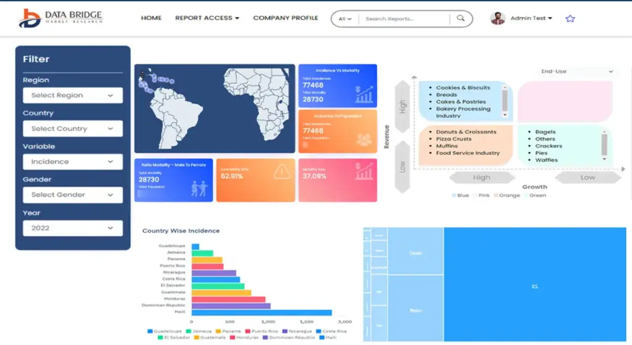
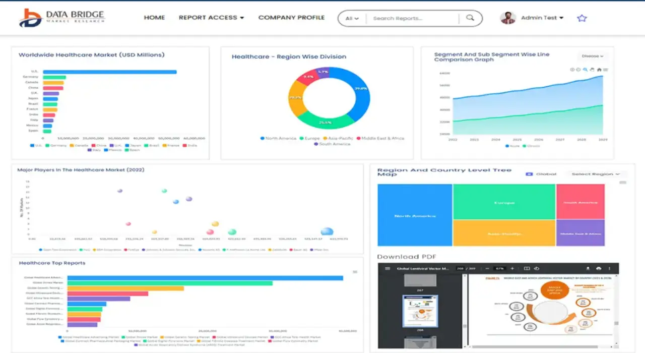
- 대화형 데이터 분석 대시보드
- 높은 성장 잠재력 기회를 위한 회사 분석 대시보드
- 사용자 정의 및 질의를 위한 리서치 분석가 액세스
- 대화형 대시보드를 통한 경쟁자 분석
- 최신 뉴스, 업데이트 및 추세 분석
- 포괄적인 경쟁자 추적을 위한 벤치마크 분석의 힘 활용
연구 방법론
데이터 수집 및 기준 연도 분석은 대규모 샘플 크기의 데이터 수집 모듈을 사용하여 수행됩니다. 이 단계에는 다양한 소스와 전략을 통해 시장 정보 또는 관련 데이터를 얻는 것이 포함됩니다. 여기에는 과거에 수집한 모든 데이터를 미리 검토하고 계획하는 것이 포함됩니다. 또한 다양한 정보 소스에서 발견되는 정보 불일치를 검토하는 것도 포함됩니다. 시장 데이터는 시장 통계 및 일관된 모델을 사용하여 분석하고 추정합니다. 또한 시장 점유율 분석 및 주요 추세 분석은 시장 보고서의 주요 성공 요인입니다. 자세한 내용은 분석가에게 전화를 요청하거나 문의 사항을 드롭하세요.
DBMR 연구팀에서 사용하는 주요 연구 방법론은 데이터 마이닝, 시장에 대한 데이터 변수의 영향 분석 및 주요(산업 전문가) 검증을 포함하는 데이터 삼각 측량입니다. 데이터 모델에는 공급업체 포지셔닝 그리드, 시장 타임라인 분석, 시장 개요 및 가이드, 회사 포지셔닝 그리드, 특허 분석, 가격 분석, 회사 시장 점유율 분석, 측정 기준, 글로벌 대 지역 및 공급업체 점유율 분석이 포함됩니다. 연구 방법론에 대해 자세히 알아보려면 문의를 통해 업계 전문가에게 문의하세요.
사용자 정의 가능
Data Bridge Market Research는 고급 형성 연구 분야의 선두 주자입니다. 저희는 기존 및 신규 고객에게 목표에 맞는 데이터와 분석을 제공하는 데 자부심을 느낍니다. 보고서는 추가 국가에 대한 시장 이해(국가 목록 요청), 임상 시험 결과 데이터, 문헌 검토, 재생 시장 및 제품 기반 분석을 포함하도록 사용자 정의할 수 있습니다. 기술 기반 분석에서 시장 포트폴리오 전략에 이르기까지 타겟 경쟁업체의 시장 분석을 분석할 수 있습니다. 귀하가 원하는 형식과 데이터 스타일로 필요한 만큼 많은 경쟁자를 추가할 수 있습니다. 저희 분석가 팀은 또한 원시 엑셀 파일 피벗 테이블(팩트북)로 데이터를 제공하거나 보고서에서 사용 가능한 데이터 세트에서 프레젠테이션을 만드는 데 도움을 줄 수 있습니다.


